NEW Nor’easter STORM COVERAGE
Nor’easter may bring 50 mph winds, rain to Sandy-hit areas : http://usnews.nbcnews.com/_news/2012/11/05/14936732-noreaster-may-bring-50-mph-winds-rain-to-sandy-hit-areas?lite
Forecasters are tracking another coastal storm that threatens cleanup and recovery efforts in New York and New Jersey after the devastation of Superstorm Sandy. What to expect?
HAZARDOUS WEATHER OUTLOOK REPORT 11-5-2012 NATIONAL WEATHER SERVICE
ALBANY NY 435 PM EST MON NOV 5 2012
THIS HAZARDOUS WEATHER OUTLOOK IS FOR
NORTHWESTERN CONNECTICUT…WESTERN MASSACHUSETTS…EAST CENTRAL NEW YORK
AND SOUTHERN VERMONT.
DAY ONE starts TONIGHT, 11-5-12 DAYS 2 THROUGH 7 (TUESDAY 11/6 THROUGH SUNDAY 11/11)
THE COMBINATION OF WINDS GUSTING 25 TO 35 MPH…COMBINING WITH POSSIBLE WET SNOW AND LIGHT ICING…COULD CAUSE ISOLATED POWER OUTAGES ACROSS MAINLY THE HIGHER TERRAIN WEDNESDAY NIGHT INTO EARLY THURSDAY.
IF CONFIDENCE INCREASES IN THIS SCENARIO…WINTER WEATHER HEADLINES COULD BE ISSUED BY TUESDAY
AREAS:
NORTHERN LITCHFIELD-SOUTHERN LITCHFIELD-NORTHERN BERKSHIRE-
SOUTHERN BERKSHIRE-NORTHERN HERKIMER-HAMILTON-SOUTHERN HERKIMER-
SOUTHERN FULTON-MONTGOMERY-NORTHERN SARATOGA-NORTHERN WARREN-
NORTHERN WASHINGTON-SCHOHARIE-WESTERN SCHENECTADY-
EASTERN SCHENECTADY-SOUTHERN SARATOGA-WESTERN ALBANY-EASTERN ALBANY-
WESTERN RENSSELAER-EASTERN RENSSELAER-WESTERN GREENE-EASTERN GREENE-
WESTERN COLUMBIA-EASTERN COLUMBIA-WESTERN ULSTER-EASTERN ULSTER-
WESTERN DUTCHESS-EASTERN DUTCHESS-NORTHERN FULTON-SOUTHEAST WARREN-
SOUTHERN WASHINGTON-BENNINGTON-WESTERN WINDHAM-EASTERN WINDHAM-
The Following HAZARDOUS WEATHER OUTLOOK IS FOR EASTERN WEST VIRGINIA… NORTHERN AND CENTRAL VIRGINIA…AND CENTRAL AND WESTERN MARYLAND WITH THE EXCEPTION OF GARRETT COUNTY.
WARNING:
A COASTAL STORM IS EXPECTED TO IMPACT THE REGION WEDNESDAY INTO THURSDAY MORNING. THERE REMAINS UNCERTAINTY WITH REGARD TO THE EXACT TRACK OF THIS SYSTEM. THERE MAY BE ENOUGH COLD AIR FOR ACCUMULATING SNOW.
AREA:
WASHINGTON-FREDERICK MD-CARROLL-MONTGOMERY-HOWARD-
EXTREME WESTERN ALLEGANY-CENTRAL AND EASTERN ALLEGANY-AUGUSTA-
ROCKINGHAM-SHENANDOAH-FREDERICK VA-PAGE-WARREN-CLARKE-NELSON-
ALBEMARLE-GREENE-MADISON-RAPPAHANNOCK-LOUDOUN-ORANGE-CULPEPER-
NORTHERN FAUQUIER-SOUTHERN FAUQUIER-WESTERN HIGHLAND-
EASTERN HIGHLAND-HAMPSHIRE-MORGAN-BERKELEY-JEFFERSON-HARDY-
WESTERN GRANT-EASTERN GRANT-WESTERN MINERAL-EASTERN MINERAL-
WESTERN PENDLETON-EASTERN PENDLETON-
THIS HAZARDOUS WEATHER OUTLOOK IS FOR THE MARYLAND PORTION OF THE CHESAPEAKE BAY…TIDAL POTOMAC RIVER…AND ADJACENT COUNTIES IN CENTRAL MARYLAND AND NORTHERN VIRGINIA AS WELL AS THE DISTRICT OF COLUMBIA.
WARNING:
A SMALL CRAFT ADVISORY IS IN EFFECT TUESDAY NIGHT FOR THE LOWER
TIDAL POTOMAC RIVER AND PORTIONS OF THE MARYLAND CHESAPEAKE BAY.

A COASTAL STORM IS EXPECTED TO IMPACT THE REGION WEDNESDAY INTO
THURSDAY MORNING. THERE REMAINS UNCERTAINTY WITH REGARD TO THE
EXACT TRACK OF THIS SYSTEM. THERE MAY BE ENOUGH COLD AIR FOR
ACCUMULATING SNOW PRIMARILY ALONG AND WEST OF INTERSTATE 95.
CHESAPEAKE BAY NORTH OF POOLES ISLAND MD-
CHESAPEAKE BAY FROM POOLES ISLAND TO SANDY POINT MD-
CHESAPEAKE BAY FROM SANDY POINT TO NORTH BEACH MD-
CHESAPEAKE BAY FROM NORTH BEACH TO DRUM POINT MD-
CHESAPEAKE BAY FROM DRUM POINT MD TO SMITH POINT VA-
TIDAL POTOMAC FROM KEY BRIDGE TO INDIAN HEAD MD-
TIDAL POTOMAC FROM INDIAN HEAD TO COBB ISLAND MD-
TIDAL POTOMAC FROM COBB ISLAND MD TO SMITH POINT VA-
PATAPSCO RIVER INCLUDING BALTIMORE HARBOR-
CHESTER RIVER TO QUEENSTOWN MD-EASTERN BAY-
CHOPTANK RIVER TO CAMBRIDGE MD AND THE LITTLE CHOPTANK RIVER-
PATUXENT RIVER TO BROOMES ISLAND MD-
TANGIER SOUND AND THE INLAND WATERS SURROUNDING BLOODSWORTH
ISLAND-DISTRICT OF COLUMBIA-NORTHERN BALTIMORE-HARFORD-
SOUTHERN BALTIMORE-PRINCE GEORGES-ANNE ARUNDEL-CHARLES-ST. MARYS-
CALVERT-PRINCE WILLIAM/MANASSAS/MANASSAS PARK-FAIRFAX-
ARLINGTON/FALLS CHURCH/ALEXANDRIA-STAFFORD-SPOTSYLVANIA-
KING GEORGE-
To see more of the report, please visit Forcast Weather.Gov

11/5/12
Latest US National Weather Service Philadelphia/Mount Holly briefing package concerning the Wednesday-Thursday storm threat.
From the Executive Summary:
• A strong coastal nor’easter will threaten the region in the November 7th-8th timeframe.
• Storm force wind gusts (55-65 mph) are likely during this storm.
• Moderate coastal flooding is likely during this storm, major coastal flooding is possible; the high tides of most concern are the ones around midday Wednesday, November 7th and the following high tide Wednesday night.
• There will be moderate to severe beach erosion during this event.
• This nor’easter will have greater impact than usual because of the serious impacts from Coastal Storm Sandy.
• There is a threat of wintry precipitation in northwest New Jersey & the Poconos.
• Next briefing package will be issued by 300 PM on Tuesday, November 6th.
• Monitor our latest weather forecast at weather.gov/phi. The website is not yet back to 100 % functionality, but much of it has been restored.
ON FACEBOOK, please join the up to the minute updates for JERSEY SHORE HURRICANE NEWS
Please subscribe to http://www.seaside-heightsnj.org/
Official Website of the Borough of Seaside Heights
Borough of Seaside Heights
901 Boulevard
Seaside Heights, NJ 08751
Telephone: 732-793-9100
Fax: 732-793-0319

FOOD AND WATER DISTRIBUTION LOCATIONS :
http://www.myfoxny.com/story/19975915/superstorm-sandy-food-water-locations
HOW CAN WE HELP?
NYC government:
If you are looking to donate time to help in Hurricane Sandy relief efforts in New York city CLICK HERE to sign up. As opportunities arise, they will contact you.
If you want to donate you can visit the Mayor’s Fund to Advance New York City
New York Cares has volunteer opportunities
If you want to volunteers in New Jersey, the state has a hotline: 1-800-JERSEY-7 ( 1-800-537-7397 ). You can also e-mail Rowena.Madden@sos.state.nj.us.
The American Red Cross is looking for cash donations and blood donations.
You can donate $10 by phone by texting the word REDCROSS to 90999.
The United Way has set up a Sandy Recovery Fund that you can donate to via the web or by texting RECOVERY to 52000 to make a $10 donation.
You can donate $10 to The Salvation Army by texting “STORM” to 80888. If you are already volunteer-certified, you can sign up to help out with disaster relief.
The Community Food Bank of New Jersey is providing 100,000 pounds of food daily to displaced families. They need volunteers and donations go online for details.
Affordable housing charity Home Habitat For Humanity is looking for donations to assist in recovery efforts. Call 800-HABITAT (422-4828) or go online.
The Community Foodbank of New Jersey is looking for financial donations and volunteers to help sort food and prepare sandwiches for distribution.
Catholic Charities is looking for donations to help assist people impacted by disasters. Jewish Federations of North America has a relief fund that you can give to online or text RELIEF to 51818 to pledge a donation.
The Jewish Federations of North America says donors may contribute to the JFNA Hurricane Relief Fund. In addition, donors may text RELIEF to 51818 on a mobile device to pledge a donation or send checks to our national mailbox at The Jewish Federations of North America, Wall Street Station, PO Box 148, New York, NY 10268. Please indicate “JFNA Hurricane Relief Fund” on all checks or in the designation box online.
Samaritan’s Purse is looking for donations and volunteers in New Jersey.
The Tunnel to Towers Foundation is also asking for donations for Staten Island residents, New York City residents or New Jersey shore residents.
FEMA also has ways to donate cash, donate goods and volunteer on its website.
If you know about any other volunteer opportunities, please post information in the comment section below so others can find out about them.
Read more: http://www.myfoxny.com/story/19988834/hurricane-sandy-how-do-i-help#ixzz2BO0sUflL
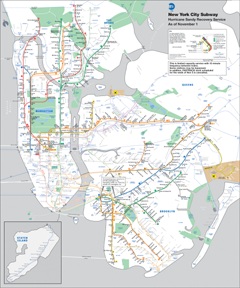
Please visit for SUBWAY information and current updates in NYC http://www.mta.info/
SubwayRecoveryMap via fox NY News
ON FACEBOOK, please join updates for JERSEY SHORE HURRICANE NEWS


