
Curious about Mars? NASA called it CURIOSITY for a reason.
When NASA scheduled it’s next rover to Mars, it was to learn more about whether Mars could be habitable for humans — particularly in terms of its weather.Does Mars have radiation? How would humans protect themselves from such a harsh environment such as all year round freezing temps and a thin atmosphere, composed mostly of carbon dioxide? –(95.32 %) to be exact. And what about water, as in where is it? Any ice?
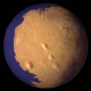
Studies have suggested that Mars was once covered in water, it’s called the Mars ocean hypothesis. MOH states that nearly a third of the surface was at one time covered by an ocean of liquid (as in water) early in the planet’s development (or geological history).
2001 :According to Astrobiology Magazine,
“To test the hypothesis that oceans once covered much of the northern hemisphere of Mars, scientists at Malin Space Science Systems (MSSS) of San Diego, CA, have used high resolution images of Mars taken with the Mars Orbiter Camera (MOC) on Mars Global Surveyor.
“The ocean hypothesis is very important, because the existence of large bodies of liquid water in the Martian past would have had a tremendous impact on ancient Martian climate and implications for the search for evidence of past life on the planet,” said Dr. Kenneth Edgett, a staff scientist at MSSS.
Features in earlier Mars probes, in particular the startling Viking images, led a number of researchers to look for remnants of ancient coastlines and further raised the possibility that such a body of water once existed.”
The idea stayed in limbo for quite sometime , water on Mars was still only a hypothetical reasoning, there was no proof.
“Evidence for this ocean includes geographic features resembling ancient shorelines, and the chemical properties of the Martian soil and atmosphere. Early Mars would have required a denser atmosphere and warmer climate to allow liquid water to remain at the surface.” We are talking 3.8 BILLION years ago, so let’s not get too excited!!!!
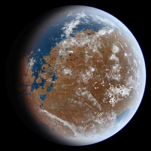
By 2009, it had all changed!
“In a new study, scientists used an innovative computer program to produce a new and more detailed global map of the valley networks on Mars, which adds to the growing body of evidence suggesting the Red Planet once had an ocean.”http://www.phenomenica.com/2009/11/new-global-map-of-mars.html ” Scientists have previously hypothesized that a single ocean existed on ancient Mars, but the issue has been hotly debated.”
So for decades MARS was under the microscope , and let’s get to the punchline here shall we, it was pronounced uninhabitable for humans, period. That is until 2012. What changed?
Let’s start with the current announcement and back track from there. I let you in on a little hypothesis of my own, and then you can decide.
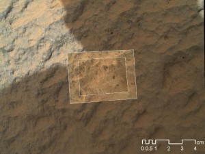
Here is a recent photo from NASA’s Rover Curiosity:
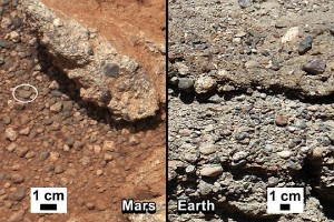
The Huffington Post recently reported that
“Researchers from the Australian National Universityhave determined that very large regions under the surface of the red planet may contain water and have sufficiently comfortable temperatures for Earth-based life — albeit microbial life.
“We found that 3 percent of the volume of Mars is habitable in terms of having the right temperatures and pressures for liquid water and life,” astrobiologist Charley Lineweaver told The Huffington Post by email. “The biggest surprise is that extensive regions of Mars could be habitable in terms of temperature, pressure and water.” http://www.huffingtonpost.com/2011/12/13/life-on-mars-we-could-be-martians_n_1144790.html
*NOTE: photos on this article have EXPIRED. (Whatever that means)
NASA is really pushing the scientific community at this point to suggest that MARS will soon be habitable for humans, but how is this possible, what happened and what is the true agenda behind this?
Here are more photos of proof NASA is bringing forward …
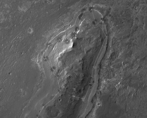
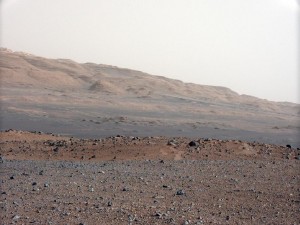

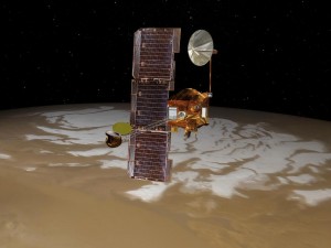
Observations by NASA’s Mars Reconnaissance Orbiter have detected carbon-dioxide snow clouds on Mars and evidence of carbon-dioxide snow falling to the surface. Image credit: NASA/JPL-Caltech › Full image and caption
PASADENA, Calif. — NASA’s Mars Reconnaissance Orbiter data have given scientists the clearest evidence yet of carbon-dioxide snowfalls on Mars. This reveals the only known example of carbon-dioxide snow falling anywhere in our solar system.
Frozen carbon dioxide, better known as “dry ice,” requires temperatures of about minus 193 degrees Fahrenheit (minus 125 Celsius), which is much colder than needed for freezing water. Carbon-dioxide snow reminds scientists that although some parts of Mars may look quite Earth-like, the Red Planet is very different. The report is being published in the Journal of Geophysical Research.
“These are the first definitive detections of carbon-dioxide snow clouds,” said the report’s lead author, Paul Hayne of NASA’s Jet Propulsion Laboratory in Pasadena, Calif. “We firmly establish the clouds are composed of carbon dioxide — flakes of Martian air — and they are thick enough to result in snowfall accumulation at the surface.”
The snowfalls occurred from clouds around the Red Planet’s south pole in winter. The presence of carbon-dioxide ice in Mars’ seasonal and residual southern polar caps has been known for decades. Also, NASA’s Phoenix Lander mission in 2008 observed falling water-ice snow on northern Mars.”
Mars’ south polar residual ice cap is the only place on the Red Planet where frozen carbon dioxide persists on the surface year-round. Just how the carbon dioxide from Mars’ atmosphere gets deposited has been in question. It is unclear whether it occurs as snow or by freezing out at ground level as frost. These results show snowfall is especially vigorous on top of the residual cap. http://www.nasa.gov/mission_pages/MRO/news/mro20120911.html
So what has changed in the past 2 decades? Well one thing for sure is a new phenomenon here on earth called Geoengineering, or Chemtrails. And another term called Terra Forming. Here is a source document from 2009:
First, check this out http://www.nasa.gov/pdf/672319main_MPPG%20NAC%20REV%2010.pdf
This explains the following
“MPPG (Mars Program Planning Group) is delivering options for NASA’s consideration on a new architecture sequence of interconnected missions with particular attention to 2018/2020 opportunities that follow MSL, Curiosity, Maven, and ESA/TGO Missions.”
Also from NASA’s website referring to TERRA-FORMING
“Returning to the most important reason for a new lunar program, dispersal of the human species, the most promising site for such dispersal is obviously Mars, now known to have an atmosphere and water. Mars itself is obviously a fascinating object for exploration. But it may even now be marginally habitable for astronaut visits, and in the very long view, might be “terraformed,” or engineered to have a more Earth-like atmosphere and climate. This was described in Kim Stanley Robinson’s trilogy, Red Mars and its successors Green and Blue Mars. A second Earth, so to speak, would greatly improve our chances of surviving cosmic catastrophes.” ~Paul D. Lowman Jr.
14 January 2008
What is terra-forming, and who conducts such a task?
Terra Forming means “Earth-shaping”.
Terraforming of Mars
Artist’s conception of the process of terraforming Mars.
The terraforming of Mars is the hypothetical process by which the climate, surface, and known properties of Mars would be deliberately changed with the goal of making it habitable by humans and other terrestrial life, thus providing the possibility of safe and sustainable colonization of large areas of the planet. The concept relies on the assumption that the environment of a planet can be altered through artificial means; the feasibility of creating a planetary biosphere is undetermined. There are several proposed methods, some of which present prohibitive economic and natural resource costs, and others which may be currently technologically achievable. http://en.wikipedia.org/wiki/Terraforming_of_Mars
The term Terra Forming is sometimes used more generally as a synonym for planetary engineering, although some consider this more general usage an error. The concept of terraforming developed from both science fiction and ACTUAL SCIENCE.
The following link describes:
National Aeronautics and Space Administration
Earth vs. Mars
LESSON DESCRIPTION
Remote satellite images of Earth and
Mars are used to compare and contrast
physical processes that occur on both
planets.
OBJECTIVES
Students will
Identify similarities and differences
between the physical processes
that occur on Earth and Mars
Classify images of Earth and Mars
by observing physical features in
each image
Speculate about the physical
features observed in each image
http://www.nasa.gov/pdf/546136main_ESS5_EarthvsMars_C3.pdf


Now hold on to your seats.
Another definition (Per NASA) for Terra Forming is GEOENGINEERING). So what is the point here? Are you connecting any dots yet?
GEOENGINEERING: planetary engineering applied specifically to the Earth. It includes only those macroengineering concepts that deal with the alteration of some global parameter, such as the greenhouse effect, atmospheric composition, insolation or impact flux.
Back to Mars:
Beginning in 1985, Martyn J. Fogg began publishing several articles on terraforming. Martyn was part of the The British Interplanetary Society (BIS) founded in 1933 by Philip E. Cleator, is the oldest Space Advocacy organisation in the world whose aim is exclusively to support and promote Astonautics and Space Exploration. Check out their website, it will blow your mind! http://www.bis-space.com/
” Once conditions become more suitable for life, the importation of microbial life could begin.” ~ Martyn J. Fogg
Is it possible that science is experimenting right here on Planet Earth? Terraforming, engineering, geoengineering the earth to test it on all of us, all living beings, all LIFE FORMS to be sure it works for another planet such as Mars?
“The colonization of Mars by humans is the focus of serious study because surface conditions, such as the availability of frozen ground water, make it the most hospitable planet in the solar system other than Earth. The Moon has been proposed as the first location for human colonization given its close proximity, but Mars has twice the gravity, more water (in ice form) and a thin atmosphere, giving it the potential capacity to host human and other organic life in more abundance than on the Moon. Both the Moon and Mars, as potential settlement sites, have the disadvantages of cost and risk associated with landing within gravity wells, which may make asteroids another option for early expansion of humans into the solar system.” http://en.wikipedia.org/wiki/Colonization_of_Mars
WHY are statements such as these being made by the scientific community?
“Recent observations by NASA‘s Mars Exploration Rovers, ESA‘s Mars Express and NASA’s Phoenix Lander confirm the presence of waterice on Mars. Mars appears to have significant quantities of all the elements necessary to support Earth-based life.”
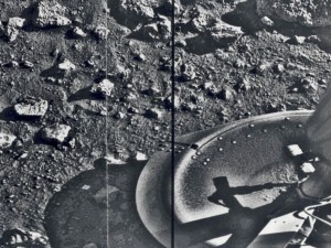
- Mars (Viking 1, 1980)
We will continue to update you on this story , as we promised you in part I. https://www.thetruthdenied.com/news/p=5052
Is it possible that the missions to Mars are because scientists and Astronauts are ready for a visit to the red planet? Or could it be that after years of GEOENGINEERING planet earth, terraforming the earth, that MARS is ready to have visitors?
One more thing. You thought I forgot about the very first question that I asked in this article, you know the one about why NASA choose to use the pyramid on the U.S.Dollar as an example to show off the power of their new lense ? Do you know the answer yet?
Please see PART ONE HERE: https://www.thetruthdenied.com/news/2012/08/05/curiosity-lands-on-mars-see-mars-photos-and-livestream/




[…] Based on experiences with Earth, the environment of a planet can be altered deliberately.See here for more of the story: http://www.thetruthdenied.com/news/2012/10/07/is-geoengineering-a-part-of-nasas-mission-to-mars-part… […]
[…] Based on experiences with Earth, the environment of a planet can be altered deliberately.See here for more of the story: http://www.thetruthdenied.com/news/2012/10/07/is-geoengineering-a-part-of-nasas-mission-to-mars-part… […]