What is RNP
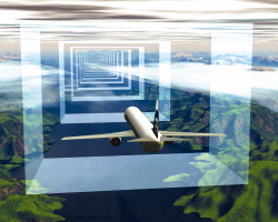
Required Navigational Performance (RNP) is a satellite based technology, it provides a 3 dimensional highway in the sky for pilots allowing for closer spacing of aircraft within the same airspace. It saves on fuel by utilizing drift and provides guidance around obstacles such as mountains or storms. Using RNP, each arrival is assigned an exact time to land long before they start the descent, and it’s all by autopilot, taking into account the weight of the plane and the headwinds. RNP is currently in use in over 70 U.S. airports and the Federal Aviation Administration’s plan is to modernize the National Airspace System (NAS) through 2025.

RNP would be benificial to both passangers and the environment for example: a flight into Seattle, WA could normally take as long as 35 minutes in queue for landing, burning up to 13,000 gallons of fuel. With RNP that could be reduced to nine minutes, burning up to a third less fuel. RNP provides efficient flight corridors and provides a significant reduction on the amount of urban and natural ecosystem disturbed by these planes including the resulting noise and emissions.
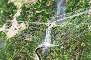
Here is a look at the flight paths into and out of the Kelowna, BC airport before the imentation of RNP. This ‘before’ image shows that there were a lot of grid patterns and X’s around the Kelowna airport; especially to the west.
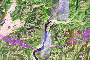
This may be good news for us because this provides our Skywatchers in places like Kelowna, Austin, Buffalo, Jacksonville, Kansas City, Sacramento, Salt Lake City and others with an opportunity to prove that the flights they are seeing that are laying the Chemtrails are not routine in or outbound from their airport. If you still see the trails and planes after the implementation and the airline traffic has been diverted – then the conclusion could be that they are either military or in our airspace outside the routine commercial traffic; add some pictures with long and lat, plus the denial of their existance and it could make a strong case. Take a look at this image of the Kelowna airport flight paths after the introduction of RNP.
Evidence Gathering
The area to the west of Kelowna now resembles a no-fly zone. Are you seeing chemtrails, grids, X’s? If so this could be valid evidence – enough for a media outlet or a law enforcement agency. If chemtrails are a natural byproduct of commercial airlines as many debinkers suggest – then the introduction of RNP into Kelowna or any of the other airports should change the chemtrail pattern seen in those areas.
Readers Alert!
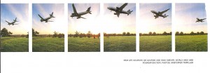
This image accompanied the original article I read regarding RNP (National Geographic, March 2012). The photo does not provide further clarification about RNP but it does have the spokes of alternating colored clouds radiating from the horizon often associated with a chemtrail spray artifact, the new flight paths seen in the second image are fanning out. Is it possible they are exactly what we would expect the persistent jet ‘con’trails to look like if we were looking backward from the Kelowna airport? Again if we saw this on a different horizon would that not be further confirmation that these planes are not ‘routine commercial.
LINKS:
http://online.wsj.com/article/SB124208754280908923.html
Departure%2520Procedures&ei=aZmAT6ijD8nRiAKdv4jLAQ&usg=AFQjCNEJQqO3ZmdgTkSe2hVj6Z-6PCPt5A
http://www.ecacnav.com/content.asp?PageID=485


